

Walks Around Marple
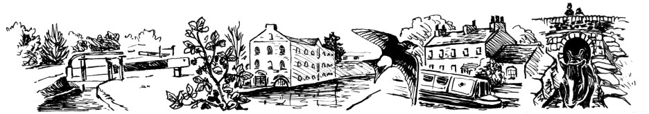
Marple is a walkers' delight, providing a mixture of superb scenery and fascinating historical features. With miles of canal tow paths, cycle tracks, heavily wooded valleys, rivers, lakes and hill top moorland the district offers a huge variety of interest.
This series of guides, designed and published by the late Gordon Mills in 1998 on behalf of Marple Community Council, provides a selection of everything Marple has to offer featured in six circular walks of 2 to 4 miles distance and averaging around 1½ hours duration. With detailed maps and photographs up to 100 years old, the guides not only direct you along the route but also explain the history of the many interesting sights you will see on the way.

Gordon, who ran his own printing business in Marple for over 35 years, gave permission for the content of his guides to be reproduced in full on The Marple Website soon after they were published. Even though it would probably result in reduced sales he was happy that visitors could print out copies for themselves should they wish to go on the walks. Gordon's decision was instrumental in the success of this web site because it gave top quality content to publish at the time of its launch and encouraged others, like photographer David Brindley, to follow his lead.
Gordon passed away in December 2006 leaving a legacy of fantastic local publications, of which these guides are just a small part. He also produced books, videos and DVDs on an array of local topics and was a keen photographer. He used these interests and the skills developed in his work as a printer to raise many thousands of pounds for the British Heart Foundation. If you do print out and enjoy the walks, please consider making a small donation to Gordon's favorite charity using this link to the British Heart Foundation web site.

There are many copies of Gordon's original guides still available and these are now in the possession of Marple Local History Society who distribute them to local outlets for sale to the public. Unfortunately in the 10 years or so since their original publication some of the details of individual walks have changed and the instructions can sometimes be difficult to follow. We are pleased to have been able to address this issue by producing an addendum leaflet in partnership with Marple Local History Society to accompany the original guides. This will be provided free of charge with any copies of the originals purchased and can also be downloaded from this site.
The text and most of the photographs in the addendum are by David Burridge, an active member of the society. The leaflet was designed and laid out by The Marple Website and the printing costs were funded by Marple Promotions in memory of Gordon. Thanks go to Hilary Atkinson, chair of the History Society, who coordinated and managed the project to get Gordon's guides back into circulation.

In the longer term the web site will work with David and Hilary to produce a fully updated set of Gordon's guides that can continue to be distributed once stocks of the originals run down. We will also be updating the versions of the walks on the web site progressively, as each individual walk is tackled, so the new versions will become available to download on-line before they can be purchased.
Click here to download the addendum leaflet. It is designed to be printed double-sided and folded in thirds but it also includes cut-lines so that you can separate the supplements for each walk. In this case it will be better to print it on two sheets of paper so that you can cut them into six sections.
Click on the covers below to proceed to the full details of each walk. These pages feature the same maps, photographs and instructions as the original guides and are supplemented with colour pictures taken more recently.
Disclaimer
Information on these walks is provided in good faith and is intended as a general guide only. You are advised to verify the accuracy of information before relying on it. It is the responsibility of individuals to approach outdoor activities such as walking with caution. Walking can be strenuous and individuals should ensure that they are fit enough before embarking upon it. If in doubt consult a doctor.
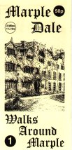 3.2 Miles. 1½ hours. UPDATED FEB 2011
This is a walk down into Marple Dale and alongside the River Goyt, with an opportunity for refreshments half way round. On the way back you will pass the site of Marple Hall, the former home of the Bradshaw family.
- Hits: 24572
 3.3 Miles. 1½ hours. UPDATED MAY 2010
One myth can be dispelled immediately, neither the lakes nor bridge have any connection with the Romans. This walk passes many of the sites of one of Marple's 18th century benefactor, Samuel Oldknow.
- Hits: 35248
 3 - 4 Miles. 1½ - 2 hrs.
This walk down Marple Locks has an option for an extended walk of another mile. Although the Peak Forest Canal had been opened for some years at the end of the 18th century, the construction of the locks was not complete until 1805 and a tramway linked the two sections.
- Hits: 46258
 2 - 3 Miles. 1 - 2 hrs.
This walk take you past the site of Marple Hall before crossing the river Goyt and making your to the ancient settlement of Chadkirk, fully described in the Domesday survey.
Chadkirk Chapel dates back to the 15th or 16th century.
- Hits: 21103
 3 Miles. 1½ hours.
The title of this walk "From Way to Cut" is derived from the Middlewood Way and the Macclesfield Canal. Canals were often referred to as the "cut" both by boatmen and the local populace.
- Hits: 24574
 2 Miles. 1 hour.
This walk is over mainly flat ground however the descent down to Donkey Wood bridge is fairly steep but steps have been provided on the particularly steep part. This walk can now be very difficult. It is not recommended but is included for the sake of completeness.
- Hits: 12605